Day 31 23 May From Georgia into Armenia and on to Lake Sevan

Photo above - Armenian flag in the town of Dilijan.
Last hours in Georgia
At 9am we left Tbilisi to drive the hour or so south to the border with Armenia at a place called Sadakhlo. We passed through mainly green flat agricultural land, with a few small villages. The area is also known for copper and gold mining. Because of the proximity to both the Armenian and Azerbaijani borders, there are quite large communities from those countries. In turn that means that the area has more Muslims than Christians in most parts.
Crossing the border
At about 10.30am we reached the border at the small town of Sadakhlo. After passing through the Georgian side, we got back on the bus, and dove over a bridge to the Armenian side, passed a queue of lorries. Then a queue on foot to go through Armenian passport control and we were in.
About Armenia
Actually called the Republic of Armenia, the country became independent in 1991 following the break up of the Soviet Union. It is landlocked and borders Georgia, Azerbaijan, Iran, and Turkey. Only two borders are open and those are with Georgia and Iran. The others have been blocked since the late 1990s. The country is 30,000 km squared, about the size of Belgium. The population is 3.2 million. There are actually more Armenians abroad, about 7 million. Top exports include copper and Brandy. Primarily an agricultural country. Also has a gold and diamond polishing industry. Chess is a mandatory subject in schools!
Armenian highlands
As we started driving we were very quickly into a mountainous region, part of the Armenian Highlands. The average elevation in the country is 1800m. The border with Georgia is actually the lowest point in the country at 400m. The road followed the river, a tributary of the Karu that we followed in Georgia, and the main railway in the country.
After about 30 minutes, we turned off the main road and started ascending to the village of Haghpat (pop 1000), which sits at about 900m. There we looked around the Christian Monastery of Haghpat, listed by UNESCO due to its outstanding ecclesiastical architecture.
Continuing south
Next we drove back down to the main road and continued south. The road continued to wind up and down through the steeply wooded slopes, following the river and the railway. We passed through the small town of Alaverdi where there was a huge partly abandoned copper smelting plant. There were a couple of spots where the road was being repaired following recent river flooding. We also saw a couple of accidents involving cars being driven by students celebrating graduation. Like in Georgia, they hire flashy cars, then drive at great speeds along the roads, with passengers hanging out of the windows and scarfs streaming from the car doors, hooting their horns. The police were at both accidents.
Amish and earthquakes
There is a community similar to Amish in Armenia, however they are descended from ethnic Russians rather than Europeans. They are called Molokans. They are Christians but have no churches. They mostly speak Russian. They live in isolation and farm the land, growing potatoes, and farming cattle. They are Slavik in appearance. We passed one of the villages where they live.
We also passed through the area where in 1988 there was a huge earthquake of 10 on the Richter scale. A whole town called Spitak was completely destroyed, and thousands were killed, many buried and never found. Even now the area is still recovering.
The valley opened up next and there were several small villages below us in the lush flat green valley. We are back in the land of the Lada again, but also lots of soviet era trucks and buses about. The road descended next, but was still passing through wooded mountain slopes.
We stopped in the picturesque town of Dilijan (pop 18,000), where we walked through a museum street, which has preserved houses dating back to the 18th century, with typical fretwork wooden balconies. The town is famous for its cold springs and humid atmosphere. Also being in central Armenia, it is a busy road travel hub.
Over the pass
Next we continued south. There is a pass over the next set of mountains called Dilijan Pass, however, a tunnel has been opened that saves an hour in time and 10km in distance. This part of the country is on the ancient silk road which we have been following on and off through Azerbaijan, and Georgia. We took the tunnel which is 2km long, and when we exited on the other side of the pass the scenery had changed, with wooded slopes replaced by completely treeless slopes as we head downwards towards Lake Sevan. Once out of the pass, the land flattenened out, despite still being quite high. The weather was even different on this side, from cold and grey to hot and sunny!
Arrival at Lake Sevan
Finally we were on the shores of the lake. Located 1900 metres above sea level, Lake Sevan is famous for its ever-changing hues, and, depending on the weather, the colour of the water can range from a deep, steely blue to a stunning turquoise. This huge body of water is the largest lake in the Caucasus region, covering an area of 940 square kilometres, and one of the largest fresh water high altitude lakes in the world. It covers 5% of the area of Armenia.
We stopped to walk up to Sevanavank Monastery, which stands on a raised piece of land on the edge of the lake. This used to be an island but is nowadays connected to the main land. A quick trot up 250 steps to get to the top of the hill and the monastery.
After coming down from the monastery, we drove round to our hotel a few km away on the other side of the lake. Tomorrow we head towards the capital of Armenia, Yerevan.

Soviet era flats in the outskirts of Tbilisi

No mans land approaching Armenian border

Village near Haghpat

Haghpat monastery
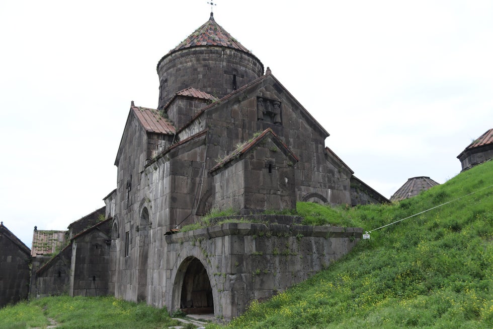
Haghpat monastery

Back in the land of ladas
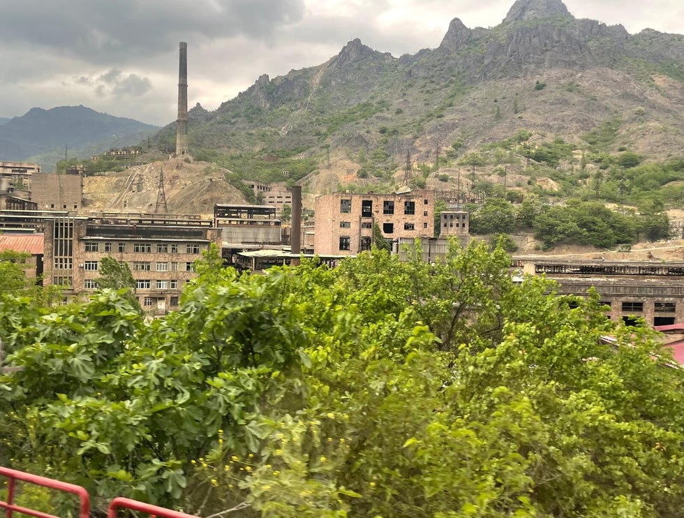
Copper smelting plant in Alaverdi

Road in the Armenian Highlands

Soviet era bus

Dilijan monument

Dilijan museum street

Sevanavank Monastery

Lake Sevan

Sevanavank Monastery
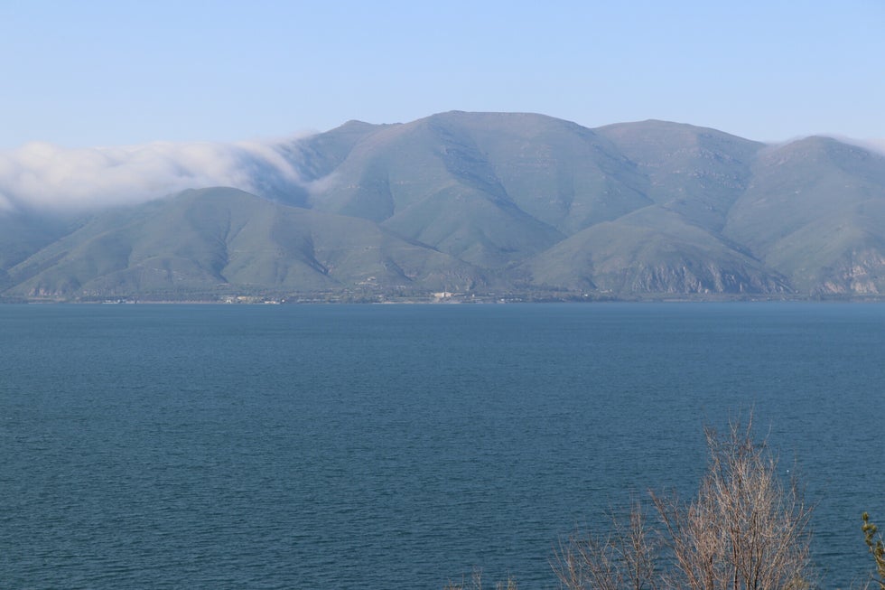
Lake Sevan

Sevanavank Monastery
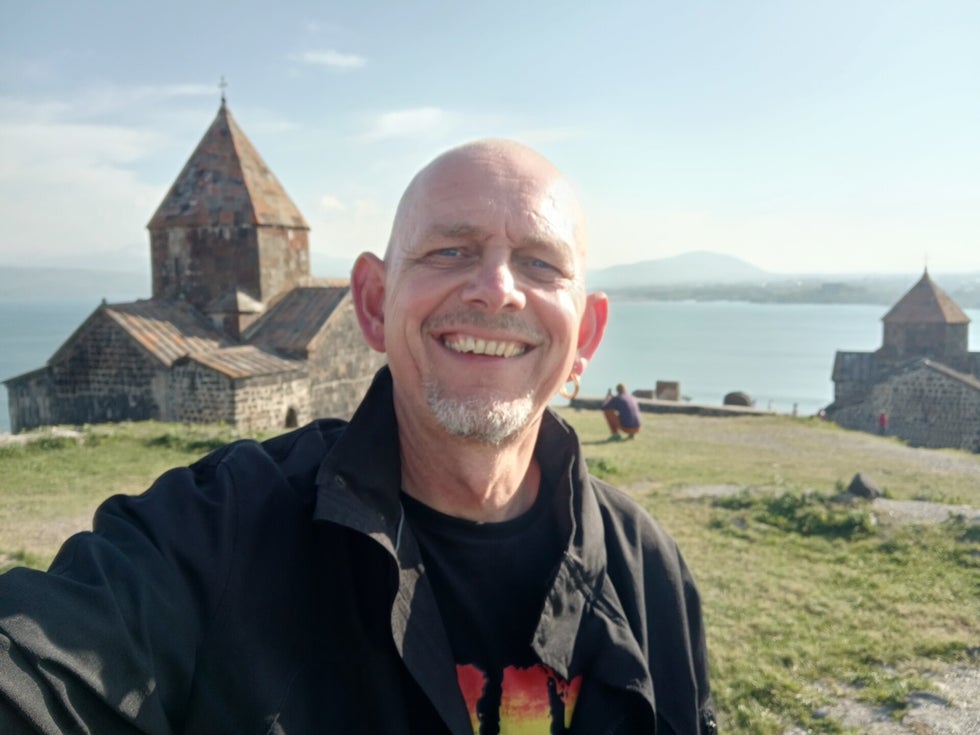
Sevanavank Monastery
Create Your Own Website With Webador