Day 26 - 28th March Drive further into the mountains in central Guinea

Photo above - large waterfall we walked to. More Photos below
4wd to the centre of Islam in this region
Early start today as we will be travelling on very bad roads. Right from the start they were terrible with the suspension of the 4wd throwing us about so much that you had to take care not to smash your head against the side windows.
After about 1.5 hours, which was probably only about 10 miles, we stopped at a small Fulani tribe village to meet with the chief. We were shown a cylindrical building that was built 500 years ago, and is where Islam started to be spread into the local area, and across the mountains.
The chief and several ‘notables’ received us inside, where the walls are plain Adobe and the floor was covered with carpets. He told us something of the way the room is used for important meetings, and that chiefs in the larger area are sworn in and tested for their suitability here. This is a tiny village, but a previous president visited seven times for a blessing.
Forest walk and waterfall
Next we drove over the terrible roads for a further half an hour, to a sight where we parked up and had some sandwiches. Then we hiked through the forest for about half an hour to a huge waterfall that cascades down a sheer cliff several hundred feet high, and into a shallow pool. It is the end of the dry season, so there was not a lot of water coming down, and it occasionally got blown about by the slight breeze.
The Highlands of Guinea
The highlands of the Fouta Djalon are known as one of Guinea’s – and West Africa’s – most beautiful areas, a region of plateaux, valleys, cliffs and grasslands, it is the source of many of West Africa’s great rivers including the Gambia and Senegal rivers, as well as a major tributary of the Niger River. Most of its inhabitants are Fula, or Fulani, people, who take advantage of the extremely fertile climate for agriculture and raising livestock; in centuries gone by the Fulani launched jihads to expand the reach of their Islamic state from here, and the region was only ‘pacified’ by the French in the late 19th century. Today it’s a peaceful place with numerous traditional villages.
4wd to the second city of Labe
Afterwards, it was back to the 4wd for more bumpy miles of dirt road, towards the second largest town in the country – Labe, which has a population of 200,000. We arrived feeling battered and bruised at about 6.30pm. amazingly, the bad roads did not get any better in the city. Without doubt, the worst roads I have travelled on in my life, and I have travelled 100s of miles through Namibia for 11 days, all on gravel roads.
Tomorrow, more bad roads, as we travel north west to the border, and cross into Guinea Bissau.
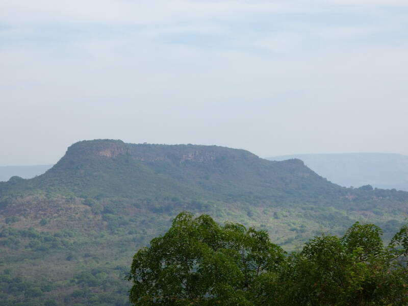
View from mountain road
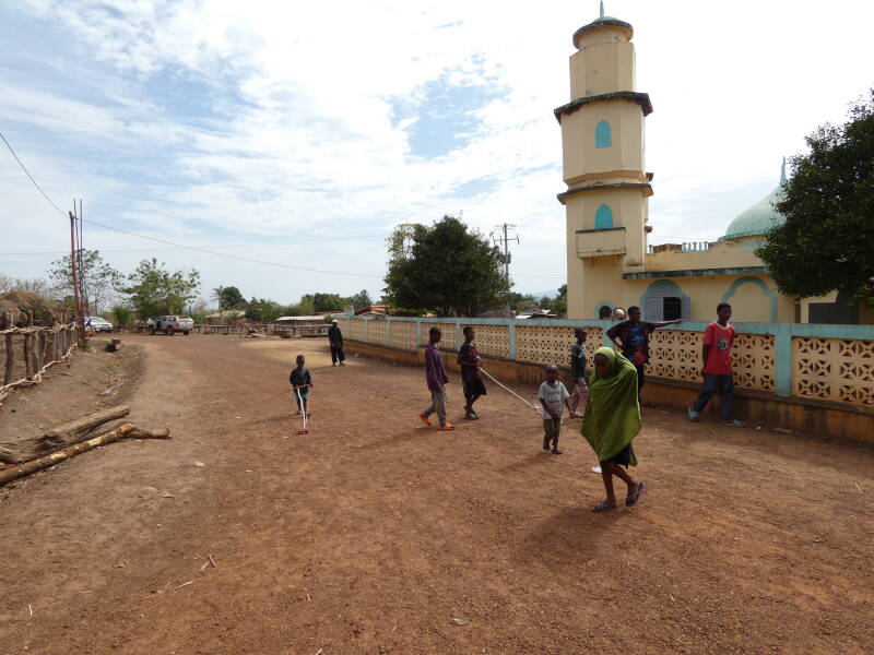
Village from where Islam spread in this region
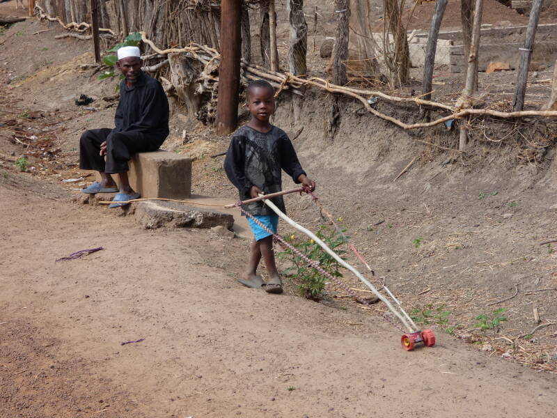
Village kid with his own homemade toy
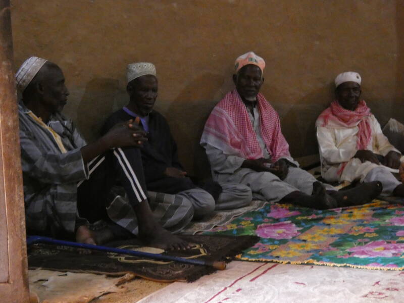
Village chief and 'notables'
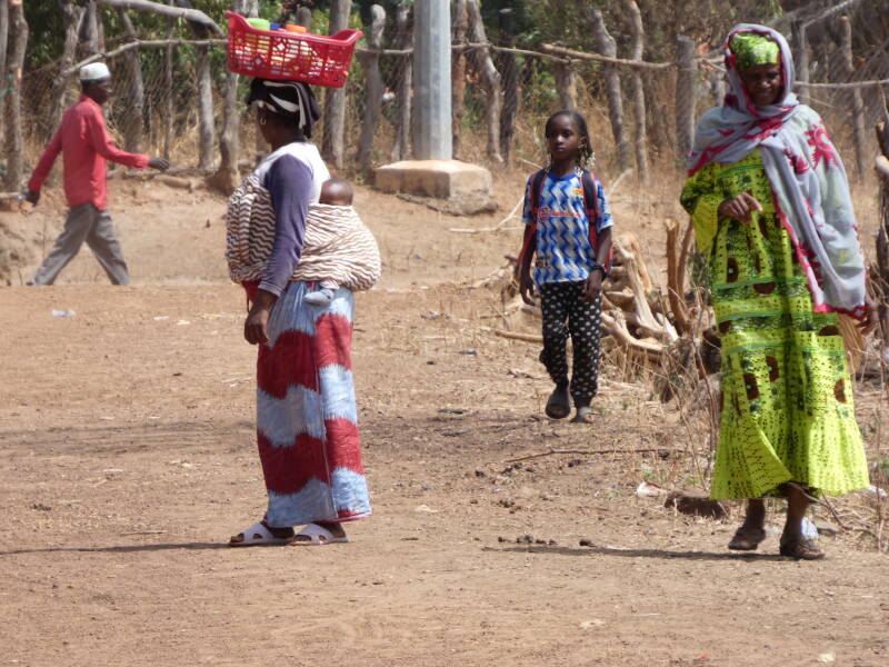
Village life
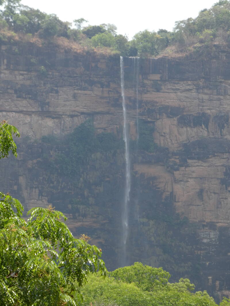
Waterfall from the start of the walk
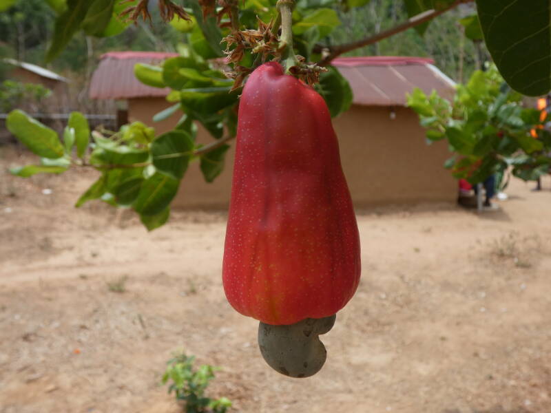
Cashew nut. The red part is eaten when ripe IE red. It starts off green when growing
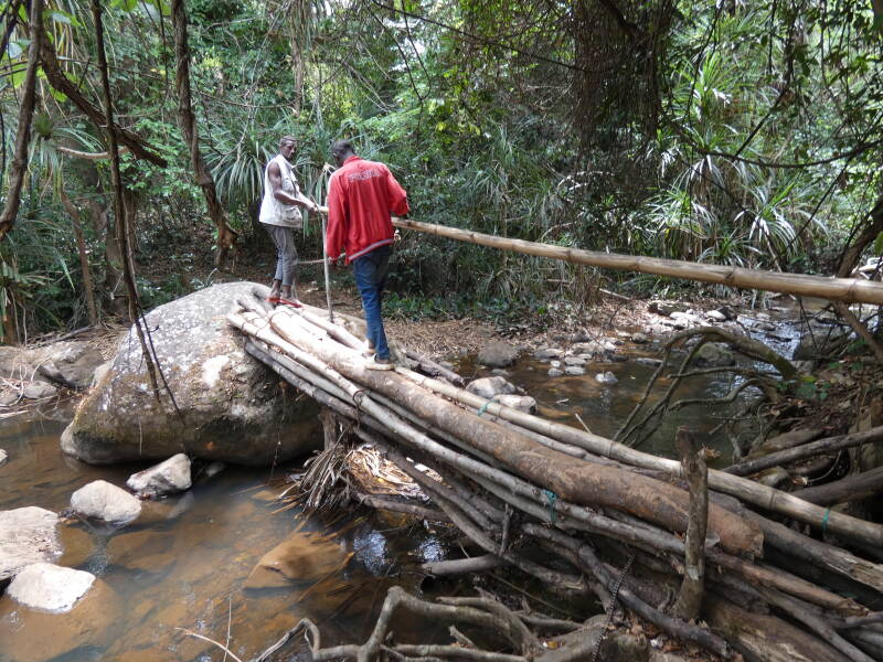
Walk through the forest included this bridge
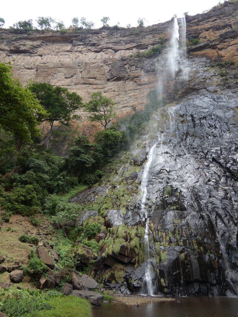
I managed to get the whole waterfall into the photo, but it does not really give the feeling of how high it was

Next to the pool at the foot of the waterfall
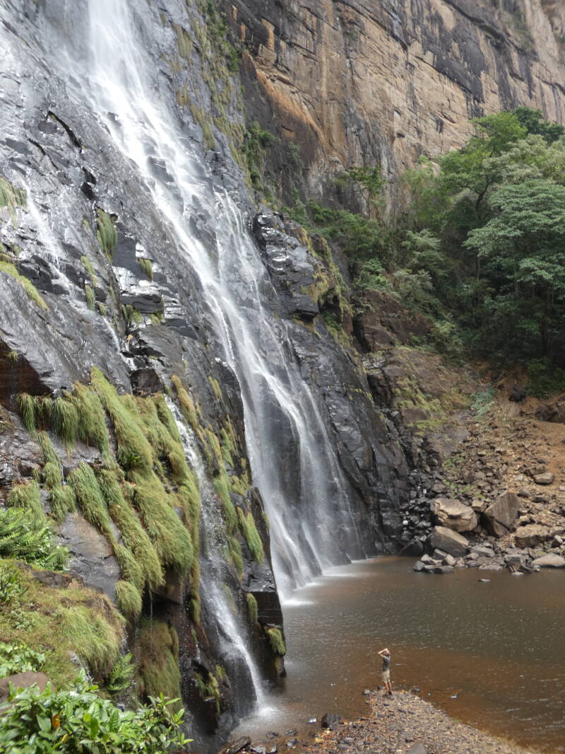
This one shows the scale of the waterfall with the person looking up right at the bottom
Create Your Own Website With Webador